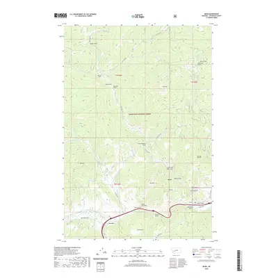
2020 Map of Basin
USGS Topo · Published 2020About this map
The settlement of Basin sits at the confluence of Basin Cr and the Boulder River, serving as a central point for the surrounding canyon landscape within the Deerlodge National Forest. This 2020 survey illustrates a region defined by its deep drainages and family-named landmarks, such as Lily of the West Gulch, Mormon Gulch, and Saul Haggerty Gulch. The transportation network is anchored by the Frontage Rd and Sunnyside Rd corridors, which follow the river valley near the community of Bernice. Significant high-elevation features include Rocker Peak, Jack Mtn, and the distinctive Indian Head Rock. The map also captures specialized infrastructure like the Klies Air Strip tucked between the ridges. This mountain terrain reflects a history of exploration and land use, with numerous gulches like Uncle Sam Gulch and Retort Gulch hinting at the area's prospecting past and the rugged geography of Jefferson County.
Find a feature on this map
51 named features on this map. Tap any name to fly to it.
Don’t see what you’re looking for? This feature index may not catch every label — zoom into the map to look around manually.
Map Details
Editions of this 2020 Basin Map
This is the sole edition of this map. No revisions or reprints were ever made.
Other maps of this area

1889 · Helena
USGS Topo · 1:250,000

1893 · Helena
USGS Topo · 1:250,000

1899 · Boulder
USGS Topo · 1:125,000

1899 · Helena
USGS Topo · 1:250,000

1903 · Helena
USGS Topo · 1:250,000

1947 · Butte
USGS Topo · 1:250,000

1950 · Jefferson City
USGS Topo · 1:62,500

1954 · Elk Park
USGS Topo · 1:62,500

1954 · Basin
USGS Topo · 1:62,500

1954 · Boulder
USGS Topo · 1:62,500