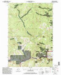
1996 Map of Basin
USGS Topo · Published 1998About this map
Basin serves as the primary hub of this high-country landscape within the Deerlodge National Forest, where the Boulder River meets Cataract Creek. The mid-1990s landscape is deeply marked by a legacy of hard-rock mining, evidenced by the high density of named workings scattered across the drainages. Significant operations like the Bullion Mine, Crystal Mine, and the Morning Mine follow the veins through complex terrain dominated by peaks like Jack Mountain and Rocker Peak.
Find a feature on this map
47 named features on this map. Tap any name to fly to it.
Don’t see what you’re looking for? This feature index may not catch every label — zoom into the map to look around manually.
Map Details
Editions of this 1996 Basin Map
This is the sole edition of this map. No revisions or reprints were ever made.
Other maps of this area

1889 · Helena
USGS Topo · 1:250,000

1893 · Helena
USGS Topo · 1:250,000

1899 · Boulder
USGS Topo · 1:125,000

1899 · Helena
USGS Topo · 1:250,000

1903 · Helena
USGS Topo · 1:250,000

1947 · Butte
USGS Topo · 1:250,000

1950 · Jefferson City
USGS Topo · 1:62,500

1954 · Elk Park
USGS Topo · 1:62,500

1954 · Basin
USGS Topo · 1:62,500

1954 · Boulder
USGS Topo · 1:62,500