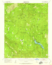
1953 Map of Bass Lake
USGS Topo · Published 1959About this map
The southern boundary of Yosemite National Park meets the working landscape of the Sierra National Forest in this 1950s survey of the central Sierra Nevada. The terrain is marked by a legacy of resource extraction and early mountain settlement, visible in the cluster of mines like the Texas Flat Mine and Enterprise Mine near Coarsegold. Notable for genealogists are the numerous family-named landmarks and rural outposts, including Harris Ranch and the Ahwahnee Sanatorium.
Find a feature on this map
125 named features on this map. Tap any name to fly to it.
Don’t see what you’re looking for? This feature index may not catch every label — zoom into the map to look around manually.
Map Details
Editions of this 1953 Bass Lake Map
4 editions found
Other maps of this area

1897 · Yosemite
USGS Topo · 1:125,000

1900 · Yosemite
USGS Topo · 1:125,000

1901 · Mt. Lyell
USGS Topo · 1:125,000

1903 · Yosemite
USGS Topo · 1:125,000

1904 · Kaiser
USGS Topo · 1:125,000

1909 · Yosemite
USGS Topo · 1:125,000

1912 · Mariposa
USGS Topo · 1:125,000

1942 · Raymond
USGS Topo · 1:62,500

1942 · Millerton Lake
USGS Topo · 1:62,500

1944 · Raymond
USGS Topo · 1:62,500