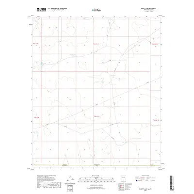
2020 Map of Bassett Lake
USGS Topo · Published 2020About this map
Bassett Lake serves as a primary landmark in this arid borderland where Otero County, New Mexico, meets Hudspeth County, Texas. This 2020 survey illustrates the vital importance of water management in the Chihuahuan Desert, as evidenced by a network of engineered catchments like Whittaker Tank, Mixen Tank, and Camaleche Tanks. The landscape is etched with local ranch and service roads, including Co RD f001 and Co RD f005, which navigate the township and range divisions of t25s r11e and t26s r11e. The state line New Mexico Texas bisects the lower portion of the sheet, defining a remote region where survival and ranching operations are tied directly to the geography of named tanks like Charley Tank and Key Tank.
Find a feature on this map
23 named features on this map. Tap any name to fly to it.
Don’t see what you’re looking for? This feature index may not catch every label — zoom into the map to look around manually.
Map Details
Editions of this 2020 Bassett Lake Map
This is the sole edition of this map. No revisions or reprints were ever made.
Other maps of this area

1903 · Cerro Alto
USGS Topo · 1:125,000

1940 · Bassett Lake
USGS Topo · 1:62,500

1941 · Heuco Mountains
USGS Topo · 1:62,500

1943 · San Antonio Mtn
USGS Topo · 1:62,500

1943 · Heuco Mountains
USGS Topo · 1:62,500

1943 · Bassett Lake
USGS Topo · 1:62,500

1954 · Carlsbad
USGS Topo · 1:250,000

1954 · Van Horn
USGS Topo · 1:250,000

1958 · Van Horn
USGS Topo · 1:250,000

1958 · Carlsbad
USGS Topo · 1:250,000