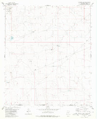
1980 Map of Bassett Lake
USGS Topo · Published 1980About this map
Fort Bliss Mil Res (Mc Gregor Range) occupies the northwestern corner of this landscape, marking a significant military footprint across the high desert terrain. This 1980 survey captures a region defined by its vital water management infrastructure, where scattered earthen structures like Escondida Tank, Whittaker Tank, and the Camaleche Tanks sustain life in an arid environment. The map also delineates the state boundary between New Mexico and Texas, as well as the border between Otero and Hudspeth counties. Centered around the eponymous Bassett Lake, the area is networked by a modern Pipeline and specialized points of interest such as a Radio Tower, reflecting the utility and strategic importance of this desert basin during the late twentieth century.
Find a feature on this map
15 named features on this map. Tap any name to fly to it.
Don’t see what you’re looking for? This feature index may not catch every label — zoom into the map to look around manually.
Map Details
Editions of this 1980 Bassett Lake Map
This is the sole edition of this map. No revisions or reprints were ever made.
Other maps of this area

1903 · Cerro Alto
USGS Topo · 1:125,000

1940 · Bassett Lake
USGS Topo · 1:62,500

1941 · Heuco Mountains
USGS Topo · 1:62,500

1943 · San Antonio Mtn
USGS Topo · 1:62,500

1943 · Heuco Mountains
USGS Topo · 1:62,500

1943 · Bassett Lake
USGS Topo · 1:62,500

1954 · Carlsbad
USGS Topo · 1:250,000

1954 · Van Horn
USGS Topo · 1:250,000

1958 · Van Horn
USGS Topo · 1:250,000

1958 · Carlsbad
USGS Topo · 1:250,000