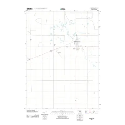
2011 Map of Bassett
USGS Topo · Published 2011About this map
Bassett serves as the hub of this Rock County landscape, situated where the high plains transition into the drainage of the North Br Elkhorn River. This 2011 survey captures the town's civic core, including the Bassett Post Office and the expansive Rock County Fairgrounds located near the intersection of several regional travel routes. Local infrastructure like the Rock County Airport and recreational spaces such as Bassett Memorial Park and Bassett Tourist Park illustrate the community's role as a regional center. To the west, the Frauen Ranch denotes the continued presence of large-scale cattle ranching operations that characterize the agricultural heritage of the Sandhills periphery. Detailed street labels including Park St and Skyline Dr provide precise navigation within the town limits.
Find a feature on this map
10 named features on this map. Tap any name to fly to it.
Don’t see what you’re looking for? This feature index may not catch every label — zoom into the map to look around manually.
Map Details
Editions of this 2011 Bassett Map
This is the sole edition of this map. No revisions or reprints were ever made.
Other maps of this area

1949 · Riverview
USGS Topo · 1:24,000

1949 · Carns
USGS Topo · 1:24,000

1950 · Bassett NW
USGS Topo · 1:24,000

1950 · Carns
USGS Topo · 1:24,000

1950 · Riverview
USGS Topo · 1:24,000

1954 · Long Pine
USGS Topo · 1:24,000

1954 · Bassett
USGS Topo · 1:24,000

1954 · Newport SW
USGS Topo · 1:24,000

1955 · O'Neill
USGS Topo · 1:250,000

1959 · O'Neill
USGS Topo · 1:250,000