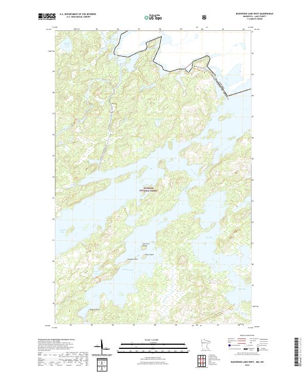
2022 Map of Basswood Lake West
USGS Topo · Published 2022About this map
Superior National Forest encompasses this intricate borderland landscape, defined by the complex aquatic network of the Boundary Waters. The international boundary with Canada cuts through the northern waters of Basswood Lake, where Lower Basswood Falls marks a significant hydraulic transition. Historical movement through this wilderness is traced by several designated routes, including the 4-Mile Portage Trl and the Jackfish-Horse Winter Trl, which provide vital terrestrial links between major water bodies like Jackfish Bay and Horse River.
Find a feature on this map
25 named features on this map. Tap any name to fly to it.
Don’t see what you’re looking for? This feature index may not catch every label — zoom into the map to look around manually.
Map Details
Editions of this 2022 Basswood Lake West Map
This is the sole edition of this map. No revisions or reprints were ever made.
Other maps of this area

1933 · Ely
USGS Topo · 1:62,500

1939 · Ely
USGS Topo · 1:62,500

1954 · Two Harbors
USGS Topo · 1:250,000

1957 · Two Harbors
USGS Topo · 1:250,000

1957 · Gabbro Lake
USGS Topo · 1:62,500

1957 · Basswood Lake
USGS Topo · 1:62,500

1957 · Quetico
USGS Topo · 1:250,000

1958 · Two Harbors
USGS Topo · 1:250,000

1963 · Fourtown Lake
USGS Topo · 1:24,000
1963 · Friday Bay
USGS Topo · 1:24,000