
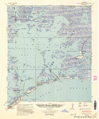
1935 Map of Bastian Bay
USGS Topo · Published 1935About this map
Bastian Bay and the surrounding marshlands of Plaquemines Parish reveal a dynamic coastal environment as it existed in the mid-1930s. The landscape is a labyrinth of waterways, where the Grand Bayou serves as a primary artery connecting the interior wetlands to the Gulf of Mexico. Small, isolated settlements or outposts such as Bastian, Wise, Huertes, and De Suite appear along the banks of these bayous, likely serving as focal points for local fishing or trapping activities. The survey details a fragile barrier system including Bastian Island and Shell Island, which separate Bastian Bay and Shell Island Bay from the open sea. This mapping, compiled from aerial photographs, provides an important record of the Louisiana coastline before significant land loss and coastal erosion altered the footprints of places like Bay Chaland and Adams Bay.
Find a feature on this map
27 named features on this map. Tap any name to fly to it.
Don’t see what you’re looking for? This feature index may not catch every label — zoom into the map to look around manually.
Map Details
Editions of this 1935 Bastian Bay Map
This is the sole edition of this map. No revisions or reprints were ever made.
Other maps of this area

1892 · Quarantine
USGS Topo · 1:62,500

1893 · Fort Livingston
USGS Topo · 1:62,500

1935 · Port Sulphur
USGS Topo · 1:31,680

1935 · Bay Ronquille
USGS Topo · 1:31,680

1935 · Tropical Bend
USGS Topo · 1:31,680

1941 · Empire
USGS Topo · 1:62,500

1944 · Empire
USGS Topo · 1:62,500

1947 · Buras
USGS Topo · 1:31,680

1947 · Bay Ronquille
USGS Topo · 1:31,680
1948 · Fort Livingston
USGS Topo · 1:62,500