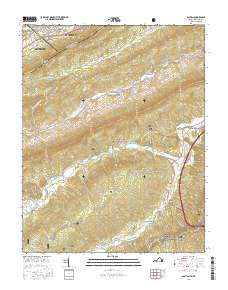
2016 Map of Bastian
USGS Topo · Published 2016About this map
Bluefield and South Bluefield anchor the northern reaches of this cross-border survey, where the collegiate grounds of Bluefield Coll meet the steep slopes of E River Mtn. This high-altitude landscape is defined by the ridge-and-valley transition between Mercer County, West Virginia, and Bland County, Virginia. To the south, the terrain descends into the protected woodlands of the Jefferson National Forest, where the small settlements of Bastian and Hicksville sit along the banks of Wolf Creek. The drainage patterns of Clear Fork and Hunting Camp Cr reveal a network of mountain valleys that have historically dictated the placement of roads like State Rte 613 and Clear Fork Creek Rd. For those interested in the cultural landscape, the map identifies the Rose Hill Cem near Bastian and the winding path of the Appalachian National Scenic Trail as it traverses Brushy Mtn.
Find a feature on this map
44 named features on this map. Tap any name to fly to it.
Don’t see what you’re looking for? This feature index may not catch every label — zoom into the map to look around manually.
Map Details
Editions of this 2016 Bastian Map
This is the sole edition of this map. No revisions or reprints were ever made.
Other maps of this area

1887 · Pocahontas
USGS Topo · 1:125,000

1891 · Pocahontas
USGS Topo · 1:125,000

1894 · Pocahontas
USGS Topo · 1:125,000

1895 · Pocahontas
USGS Topo · 1:125,000

1909 · Pocahontas Special
USGS Topo · 1:48,000

1911 · Pocahontas Special
USGS Topo · 1:62,500

1913 · Bluefield
USGS Topo · 1:48,000

1916 · Bluefield
USGS Topo · 1:62,500

1924 · Bramwell
USGS Topo · 1:62,500

1924 · Bluefield
USGS Topo · 1:62,500