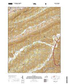
2019 Map of Bastian
USGS Topo · Published 2019About this map
Bluefield and South Bluefield anchor the northern edge of this landscape, where the urban grid gives way to the dense forest and ridges of the Jefferson National Forest. This terrain is defined by its deep creek valleys, with Wolf Creek and the Clear Fork winding through the center of the sheet. The settlement of Bastian sits at the eastern foot of these mountains, near the Rose Hill Cem and the southern passage of the Appalachian National Scenic Trail.
Find a feature on this map
44 named features on this map. Tap any name to fly to it.
Don’t see what you’re looking for? This feature index may not catch every label — zoom into the map to look around manually.
Map Details
Editions of this 2019 Bastian Map
This is the sole edition of this map. No revisions or reprints were ever made.
Other maps of this area

1887 · Pocahontas
USGS Topo · 1:125,000

1891 · Pocahontas
USGS Topo · 1:125,000

1894 · Pocahontas
USGS Topo · 1:125,000

1895 · Pocahontas
USGS Topo · 1:125,000

1909 · Pocahontas Special
USGS Topo · 1:48,000

1911 · Pocahontas Special
USGS Topo · 1:62,500

1913 · Bluefield
USGS Topo · 1:48,000

1916 · Bluefield
USGS Topo · 1:62,500

1924 · Bramwell
USGS Topo · 1:62,500

1924 · Bluefield
USGS Topo · 1:62,500