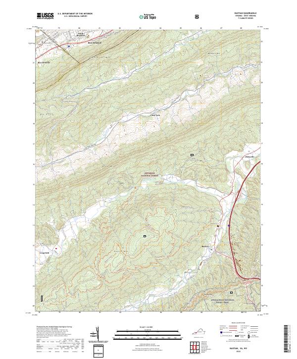
2022 Map of Bastian
USGS Topo · Published 2022About this map
Bastian and the surrounding mountain ridges of Bland County appear here in a contemporary context, shaped by the Jefferson National Forest and the rugged topography of the Ridge-and-Valley Appalachians. The landscape is defined by parallel heights including East River Mtn, Rich Mtn, and Brushy Mtn, with narrow valleys hosting communities like Hicksville and Grapefield. Waterways such as Wolf Creek and Clear Fork have historically dictated the placement of roads and settlements, while modern recreational use is evidenced by an extensive network of named paths such as Goose Trl and the iconic Appalachian National Scenic Trail.
Find a feature on this map
54 named features on this map. Tap any name to fly to it.
Don’t see what you’re looking for? This feature index may not catch every label — zoom into the map to look around manually.
Map Details
Editions of this 2022 Bastian Map
This is the sole edition of this map. No revisions or reprints were ever made.
Other maps of this area

1887 · Pocahontas
USGS Topo · 1:125,000

1891 · Pocahontas
USGS Topo · 1:125,000

1894 · Pocahontas
USGS Topo · 1:125,000

1895 · Pocahontas
USGS Topo · 1:125,000

1909 · Pocahontas Special
USGS Topo · 1:48,000

1911 · Pocahontas Special
USGS Topo · 1:62,500

1913 · Bluefield
USGS Topo · 1:48,000

1916 · Bluefield
USGS Topo · 1:62,500

1924 · Bramwell
USGS Topo · 1:62,500

1924 · Bluefield
USGS Topo · 1:62,500