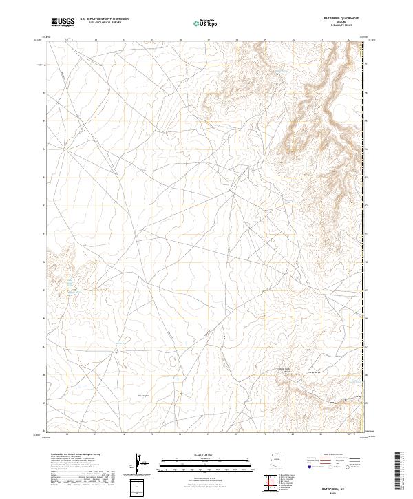
2021 Map of Bat Spring
USGS Topo · Published 2021About this map
Water sources like Willow Spring and Bat Spring anchor this portion of the Coconino County landscape, illustrating the critical importance of reliable hydrology in this arid region. The geography is defined by significant relief, most notably at Rough Rock Point and the deep drainage of Bat Canyon in the southern portion of the sheet. Transportation is restricted to primary corridors such as Indian Rte 1 and Indian Rte 7, which navigate the plateaus and bypass the more complex terrain. These routes, alongside smaller features like Badger Spring and Lower Badger Spring, reflect a settlement and transit pattern dictated by topography and the availability of water, while the remote drainage of Tolah Nascin marks the eastern edge of the survey area.
Find a feature on this map
14 named features on this map. Tap any name to fly to it.
Don’t see what you’re looking for? This feature index may not catch every label — zoom into the map to look around manually.
Map Details
Editions of this 2021 Bat Spring Map
This is the sole edition of this map. No revisions or reprints were ever made.
Other maps of this area

1883 · Marsh Pass
USGS Topo · 1:250,000

1883 · Tusayan
USGS Topo · 1:250,000

1886 · Tusayan
USGS Topo · 1:250,000

1892 · Marsh Pass
USGS Topo · 1:250,000

1947 · Flagstaff
USGS Topo · 1:250,000

1954 · Flagstaff
USGS Topo · 1:250,000

1956 · Marble Canyon
USGS Topo · 1:250,000

1958 · Flagstaff
USGS Topo · 1:250,000

1959 · Marble Canyon
USGS Topo · 1:250,000

1960 · Flagstaff
USGS Topo · 1:250,000