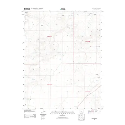
2013 Map of Bates Lake
USGS Topo · Published 2013About this map
Simpson lies at the southern edge of this Colorado high-plains landscape, where the semi-arid terrain is defined by a complex network of arroyos and canyons. The Apishapa River cuts through the western portion of the quadrangle, flanked by geographic landmarks like Apishapa Canyon and West Cross Canyon. Water management is central to the area's geography, evidenced by features such as Bates Lake, Bates Reservoir, and Rowe Reservoir.
Find a feature on this map
32 named features on this map. Tap any name to fly to it.
Don’t see what you’re looking for? This feature index may not catch every label — zoom into the map to look around manually.
Map Details
Editions of this 2013 Bates Lake Map
This is the sole edition of this map. No revisions or reprints were ever made.
Other maps of this area

1891 · Apishapa
USGS Topo · 1:125,000

1892 · Elmoro
USGS Topo · 1:125,000

1893 · Apishapa
USGS Topo · 1:125,000

1893 · Elmoro
USGS Topo · 1:125,000

1897 · Elmoro
USGS Topo · 1:125,000

1897 · Apishapa
USGS Topo · 1:125,000

1954 · Trinidad
USGS Topo · 1:250,000

1955 · Trinidad
USGS Topo · 1:250,000

1958 · Trinidad
USGS Topo · 1:250,000

1959 · Trinidad
USGS Topo · 1:250,000