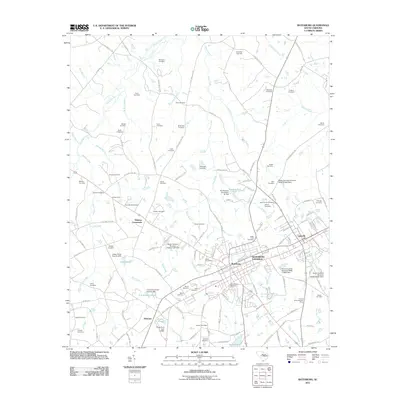
2011 Map of Batesburg
USGS Topo · Published 2011About this map
Batesburg-Leesville anchors this 2011 survey, showing the unified character of these two historic South Carolina towns along the rail corridor. The surrounding landscape in Saluda and Lexington Counties is densely marked by family and community heritage, evidenced by the high concentration of named burial grounds such as Mitchell Cemetery, Olive Branch Cemetery, and Ridge Crest Cemetery. Beyond the municipal center, smaller communities like Holston Crossroads and Hibernia sit among a complex network of creeks including Clouds Creek, West Creek, and Chinquapin Creek.
Find a feature on this map
151 named features on this map. Tap any name to fly to it.
Don’t see what you’re looking for? This feature index may not catch every label — zoom into the map to look around manually.
Map Details
Editions of this 2011 Batesburg Map
This is the sole edition of this map. No revisions or reprints were ever made.
Other maps of this area

1904 · Columbia
USGS Topo · 1:125,000

1941 · Spartanburg
USGS Topo · 1:250,000

1944 · Gilbert
USGS Topo · 1:62,500

1953 · Spartanburg
USGS Topo · 1:250,000

1954 · Augusta
USGS Topo · 1:250,000

1957 · Augusta
USGS Topo · 1:250,000

1958 · Augusta
USGS Topo · 1:250,000

1960 · Spartanburg
USGS Topo · 1:250,000

1961 · Augusta
USGS Topo · 1:250,000

1962 · Augusta
USGS Topo · 1:250,000
Featured Places
- Holston Crossroads, SC
- Batesburg, Batesburg-Leesville
- Batesburg-Leesville, SC
- Leesville, Batesburg-Leesville
- Hibernia, SC