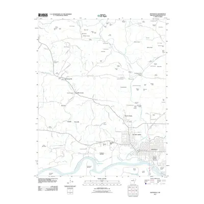
2011 Map of Batesville
USGS Topo · Published 2011About this map
Batesville anchor the southeast corner of this survey, where the White River flows past Luster Island and Brush Island. The landscape is a dense network of upland mining operations and family-named cemeteries, reflecting generations of mineral extraction and settlement. Numerous prospects and pits like the Wildcat Mine, Shell Mine, and Perrin Mine are scattered across the hills, while the White River valley south of Ruddell Hill shows the transition from industrial highlands to the Greenbrier Bottoms.
Find a feature on this map
154 named features on this map. Tap any name to fly to it.
Don’t see what you’re looking for? This feature index may not catch every label — zoom into the map to look around manually.
Map Details
Editions of this 2011 Batesville Map
This is the sole edition of this map. No revisions or reprints were ever made.
Other maps of this area

1890 · Batesville
USGS Topo · 1:125,000

1891 · Batesville
USGS Topo · 1:125,000

1942 · Bethesda
USGS Topo · 1:24,000

1942 · Jamestown
USGS Topo · 1:31,680

1942 · Almond
USGS Topo · 1:31,680

1942 · Salado
USGS Topo · 1:31,680

1942 · Batesville
USGS Topo · 1:31,680

1942 · Mt Pleasant
USGS Topo · 1:31,680

1943 · Sandtown
USGS Topo · 1:24,000

1943 · Cave City
USGS Topo · 1:31,680