
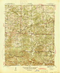
1943 Map of Sandtown
USGS Topo · Published 1943About this map
Polk Bayou and its numerous tributaries, including Barren Fork and Montgomery Creek, carve a detailed network of hollows and ridges across this wartime Arkansas landscape. The era’s rural infrastructure is well-defined by isolated community centers like Sidney and Sandtown, each supported by local institutions such as St Pauls Ch, Liberty Sch, and Wolf Sch.
Find a feature on this map
67 named features on this map. Tap any name to fly to it.
Don’t see what you’re looking for? This feature index may not catch every label — zoom into the map to look around manually.
Map Details
Editions of this 1943 Sandtown Map
4 editions found
Other maps of this area

1890 · Batesville
USGS Topo · 1:125,000

1891 · Batesville
USGS Topo · 1:125,000

1942 · Bethesda
USGS Topo · 1:24,000

1942 · Batesville
USGS Topo · 1:31,680

1942 · Mt Pleasant
USGS Topo · 1:31,680

1943 · Cave City
USGS Topo · 1:31,680

1943 · Sulphur Rock
USGS Topo · 1:31,680

1943 · Batesville
USGS Topo · 1:24,000

1951 · Melbourne
USGS Topo · 1:62,500

1953 · Memphis
USGS Topo · 1:250,000