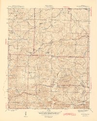
1943 Map of Sandtown
USGS Topo · Published 1945About this map
Polk Southard Mines and the Montgomery Mine signal a landscape defined by mid-century extraction at the border of Independence, Sharp, and Izard Counties. This 1943 survey documents a rural Arkansas interior where industry and community were closely tied to the terrain, from the industrial Aydelotte Washer near Tate Spr to the numerous family and community landmarks. The map traces a network of upland settlements like Mt Pleasant and Sidney, connected by a web of creeks and branches.
Find a feature on this map
66 named features on this map. Tap any name to fly to it.
Don’t see what you’re looking for? This feature index may not catch every label — zoom into the map to look around manually.
Map Details
Editions of this 1943 Sandtown Map
4 editions found
Other maps of this area

1890 · Batesville
USGS Topo · 1:125,000

1891 · Batesville
USGS Topo · 1:125,000

1942 · Bethesda
USGS Topo · 1:24,000

1942 · Batesville
USGS Topo · 1:31,680

1942 · Mt Pleasant
USGS Topo · 1:31,680

1943 · Sandtown
USGS Topo · 1:24,000

1943 · Cave City
USGS Topo · 1:31,680

1943 · Sulphur Rock
USGS Topo · 1:31,680

1943 · Batesville
USGS Topo · 1:24,000

1951 · Melbourne
USGS Topo · 1:62,500