
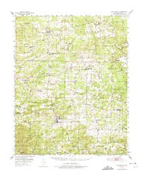
1951 Map of Melbourne
USGS Topo · Published 1952About this map
Melbourne serves as the focal point of this North Arkansas landscape, situated amidst a dense network of upland townships and small rural communities. The map depicts a post-war era of established agriculture and localized industry, where the Strawberry River and its tributaries like Piney Fork and Hurricane Creek dictate the movement of roads and settlements. A high density of rural religious and civic life is evident through numerous landmarks such as Philadelphia Ch, Chapel Hill Ch, and Forest Chapel, which sit alongside family and community burial grounds including Watkins Cem and Bethlehem Cem. Higher elevations are marked by utilitarian structures like the Oxford Lookout Tower and Sage Lookout Tower, while natural features like Melbourne Cave and the heights of Bald Mountain provide a glimpse into the diverse topography of Izard County. The scattered distribution of hamlets like Lunenburg, Violet Hill, and Brockwell reflects a traditional Ozark settlement pattern centered on creek valleys and ridge roads.
Find a feature on this map
112 named features on this map. Tap any name to fly to it.
Don’t see what you’re looking for? This feature index may not catch every label — zoom into the map to look around manually.
Map Details
Editions of this 1951 Melbourne Map
2 editions found
Other maps of this area

1890 · Batesville
USGS Topo · 1:125,000

1890 · Mountain Home
USGS Topo · 1:125,000

1891 · Mountain Home
USGS Topo · 1:125,000

1891 · Batesville
USGS Topo · 1:125,000

1892 · Mountain View
USGS Topo · 1:125,000

1894 · Mountain View
USGS Topo · 1:125,000

1894 · Mountain Home
USGS Topo · 1:125,000

1942 · Mt Pleasant
USGS Topo · 1:31,680

1943 · Sandtown
USGS Topo · 1:24,000

1945 · Harrison
USGS Topo · 1:250,000