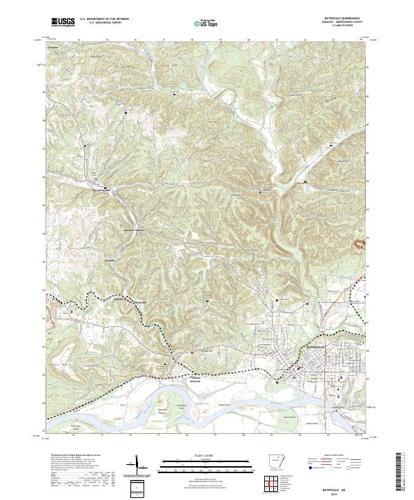
2024 Map of Batesville
USGS Topo · Published 2024About this map
Batesville serves as the regional anchor on the north bank of the White River, dominated by its riverfront history and institutional landmarks like Lyon College. The town's civic heart is marked by the Independence County Courthouse and Memorial Park, while its surroundings show a transition into the Ozark foothills through rugged hollows and ridges. This modern survey captures a landscape where historical river crossings like Gainer Ferry, Greenbrier Ferry, and Ramsey Ferry once connected the community to islands such as Earnheart Island and Luster Island.
Find a feature on this map
160 named features on this map. Tap any name to fly to it.
Don’t see what you’re looking for? This feature index may not catch every label — zoom into the map to look around manually.
Map Details
Editions of this 2024 Batesville Map
This is the sole edition of this map. No revisions or reprints were ever made.
Other maps of this area

1890 · Batesville
USGS Topo · 1:125,000

1891 · Batesville
USGS Topo · 1:125,000

1942 · Bethesda
USGS Topo · 1:24,000

1942 · Jamestown
USGS Topo · 1:31,680

1942 · Almond
USGS Topo · 1:31,680

1942 · Salado
USGS Topo · 1:31,680

1942 · Batesville
USGS Topo · 1:31,680

1942 · Mt Pleasant
USGS Topo · 1:31,680

1943 · Sandtown
USGS Topo · 1:24,000

1943 · Cave City
USGS Topo · 1:31,680