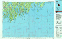
1985 Map of Bath
USGS Topo · Published 1994About this map
The Midcoast region of Maine unfolds across this mid-1980s topographic record, detailing the complex network of tidal rivers and jagged peninsulas that define the landscape from Casco Bay to Penobscot Bay. Significant maritime and educational landmarks are prominent, including the historic campus of Bowdoin College in Brunswick and the Maine Maritime Museum located in the shipbuilding center of Bath. The map illustrates the era's infrastructure with the Brunswick Naval Air Station and the tracks of the Maine Central Railroad serving the coastal towns.
Find a feature on this map
193 named features on this map. Tap any name to fly to it.
Don’t see what you’re looking for? This feature index may not catch every label — zoom into the map to look around manually.
Map Details
Editions of this 1985 Bath Map
2 editions found
Other maps of this area

1892 · Gardiner
USGS Topo · 1:62,500

1892 · Freeport
USGS Topo · 1:62,500

1893 · Small Point
USGS Topo · 1:62,500

1893 · Casco Bay
USGS Topo · 1:62,500

1893 · Wiscasset
USGS Topo · 1:62,500

1893 · Boothbay
USGS Topo · 1:62,500

1894 · Bath
USGS Topo · 1:62,500

1904 · Vinalhaven
USGS Topo · 1:62,500

1904 · Monhegan
USGS Topo · 1:62,500

1904 · Tenants Harbor
USGS Topo · 1:62,500