
1948 Map of Bath
USGS Topo · Published 1948About this map
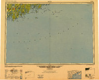
The coastal jaggedness of mid-coast Maine is on full display in this 1948 Army Map Service compilation, centered on the complex estuary where the Kennebec River and Androscoggin River meet at Merrymeeting Bay. The map documents a maritime landscape of interconnected waterways and long, narrow peninsulas, dominated by the shipbuilding hub of Bath and the historical coastal villages of Wiscasset and Boothbay Harbor. Inland, the terrain is marked by the distinct north-south orientation of the Sheepscot River and Damariscotta River. Further out in the Atlantic Ocean, the map provides crucial navigational detail for offshore outposts like Monhegan Island, Matinicus Island, and the isolated lighthouse at Mount Desert Rock. This era reflects the region's post-war infrastructure, showing the established path of Us 1 connecting the river towns and the branching state routes leading to coastal points like Pemaquid Point and Small Point Beach.
Find a feature on this map
68 named features on this map. Tap any name to fly to it.
Don’t see what you’re looking for? This feature index may not catch every label — zoom into the map to look around manually.
Map Details
Editions of this 1948 Bath Map
2 editions found
Other maps of this area

1892 · Gardiner
USGS Topo · 1:62,500

1892 · Freeport
USGS Topo · 1:62,500

1893 · Small Point
USGS Topo · 1:62,500

1893 · Casco Bay
USGS Topo · 1:62,500

1893 · Wiscasset
USGS Topo · 1:62,500

1893 · Boothbay
USGS Topo · 1:62,500

1894 · Bath
USGS Topo · 1:62,500

1904 · Deer Isle
USGS Topo · 1:62,500

1904 · Swan Island
USGS Topo · 1:62,500

1904 · Vinalhaven
USGS Topo · 1:62,500