1963 Map of Bath
USGS Topo · Published 1963About this map
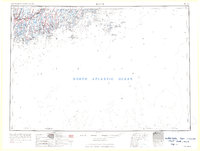
Bath and the shipyards along the Kennebec River dominate this mid-century survey of the Midcoast region. The map reveals the intricate network of tidal rivers and jagged peninsulas that defined local life, showing the Maine Central RR connecting Brunswick and Topsham to the interior. Moving east across the Sheepscot River, the landscape transitions into the maritime hubs of Boothbay Harbor and Wiscasset.
Find a feature on this map
123 named features on this map. Tap any name to fly to it.
Don’t see what you’re looking for? This feature index may not catch every label — zoom into the map to look around manually.
Map Details
Editions of this 1963 Bath Map
2 editions found

Other maps of this area

1892 · Gardiner
USGS Topo · 1:62,500

1892 · Freeport
USGS Topo · 1:62,500

1893 · Small Point
USGS Topo · 1:62,500

1893 · Casco Bay
USGS Topo · 1:62,500

1893 · Wiscasset
USGS Topo · 1:62,500

1893 · Boothbay
USGS Topo · 1:62,500

1894 · Bath
USGS Topo · 1:62,500

1904 · Deer Isle
USGS Topo · 1:62,500

1904 · Swan Island
USGS Topo · 1:62,500

1904 · Vinalhaven
USGS Topo · 1:62,500