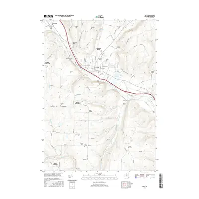
2016 Map of Bath
USGS Topo · Published 2016About this map
The Cohocton River valley defines the character of this Steuben County landscape, carving a path through high ridges such as Hickory Hill and Sharps Hill. The village of Bath serves as the central hub, surrounded by smaller historic clusters including Kanona, Knight Settlement, and Dudley Settlement. The map is particularly dense with burial sites that reflect the area's early settlement history, from the Old County Home Cem and Pioneer Cem near the town center to the Eagle Valley Cem in the eastern hills. Transportation routes are heavily influenced by the terrain, with many roads following the natural contours of Babcock Hollow and Freeman Hollow. Water features like Lake Salubria and several creek systems, including Stocking Creek and Culver Cr, provide further geographic definition to the rural reaches outside the town core.
Find a feature on this map
127 named features on this map. Tap any name to fly to it.
Don’t see what you’re looking for? This feature index may not catch every label — zoom into the map to look around manually.
Map Details
Editions of this 2016 Bath Map
This is the sole edition of this map. No revisions or reprints were ever made.
Other maps of this area

1903 · Hammondsport
USGS Topo · 1:62,500

1910 · Bath
USGS Topo · 1:62,500

1914 · Corning
USGS Topo · 1:62,500

1924 · Woodhull
USGS Topo · 1:48,000

1926 · Woodhull
USGS Topo · 1:62,500

1944 · Woodhull
USGS Topo · 1:62,500

1944 · Corning
USGS Topo · 1:62,500

1950 · Elmira
USGS Topo · 1:250,000

1953 · Campbell
USGS Topo · 1:24,000

1953 · Cameron
USGS Topo · 1:24,000