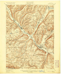
1910 Map of Bath
USGS Topo · Published 1920About this map
The Cohocton River valley serves as a bustling corridor for early 20th-century transportation and civic life, where the Delaware Lackawanna and Western RR and the Erie RR trace the water's edge. The village of Bath stands as a significant regional hub, anchored by large institutional landmarks including the State Soldiers and Sailors Home, the County House, and the State Fish Hatchery. These facilities, alongside many rural schoolhouses like Wixon School and Bucks School, illustrate the structured social fabric of Steuben County during this era.
Find a feature on this map
81 named features on this map. Tap any name to fly to it.
Don’t see what you’re looking for? This feature index may not catch every label — zoom into the map to look around manually.
Map Details
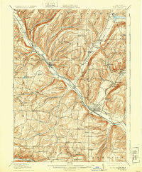
Editions of this 1910 Bath Map
4 editions found
Other maps of this area

1900 · Naples
USGS Topo · 1:62,500

1902 · Wayland
USGS Topo · 1:62,500

1903 · Naples
USGS Topo · 1:62,500

1903 · Penn Yan
USGS Topo · 1:62,500

1903 · Hammondsport
USGS Topo · 1:62,500

1904 · Wayland
USGS Topo · 1:62,500

1910 · Bath
USGS Topo · 1:62,500

1913 · Naples
USGS Topo · 1:62,500

1914 · Corning
USGS Topo · 1:62,500

1915 · Hornell
USGS Topo · 1:62,500