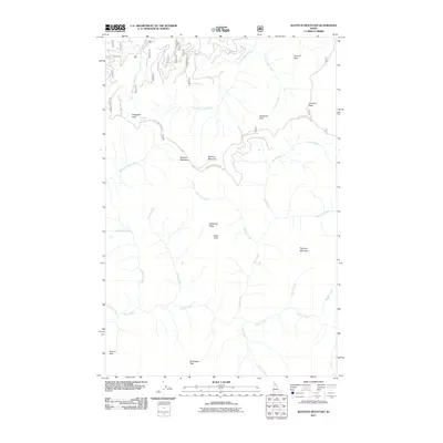
2011 Map of Bathtub Mountain
USGS Topo · Published 2011About this map
Bathtub Mountain and its surrounding peaks dominate this high-elevation landscape within the St. Joe National Forest during the early 21st century. The complex drainage network of the area is defined by the convergence of numerous named streams, including Bathtub Creek, Buck Creek, and Canyon Creek, which carve through the steep topography. Grounded in data from the U.S. Forest Service, the map highlights the critical infrastructure required to navigate this backcountry, such as ST Joe NF RD 509 and the Avery-Timber Creek Rd. Landmarks like Pineapple Spring and the expansive Bathtub Meadows provide reference points for those traversing the heights between Pappoose Mountain and Sawtooth Peak. This survey provides a precise look at the wilderness character and forest management roads of northern Idaho before subsequent landscape changes.
Find a feature on this map
40 named features on this map. Tap any name to fly to it.
Don’t see what you’re looking for? This feature index may not catch every label — zoom into the map to look around manually.
Map Details
Editions of this 2011 Bathtub Mountain Map
This is the sole edition of this map. No revisions or reprints were ever made.
Other maps of this area

1911 · Lolo
USGS Topo · 1:250,000

1913 · Lolo
USGS Topo · 1:250,000

1914 · Avery
USGS Topo · 1:125,000

1917 · Avery
USGS Topo · 1:125,000

1918 · St Regis
USGS Topo · 1:125,000

1919 · St. Regis
USGS Topo · 1:125,000

1923 · Washington Creek
USGS Topo · 1:125,000

1956 · Wallace
USGS Topo · 1:250,000

1956 · Hamilton
USGS Topo · 1:250,000

1957 · Simmons Peak
USGS Topo · 1:62,500