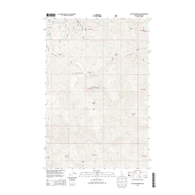
2013 Map of Bathtub Mountain
USGS Topo · Published 2013About this map
The St. Joe National Forest dominates this interior Idaho landscape, characterized by high ridges and a complex network of mountain drainages. Centered on Bathtub Mtn, the area is defined by sharp topographic reliefs like Lightning Ridge and Surveyors Ridge. High-altitude features such as Bathtub Meadows and Pineapple Peak suggest a landscape shaped by seasonal snowpack and isolation, accessible primarily via the Avery-Timber Creek Rd. The drainage patterns are intricate, with Bathtub Cr, Lightning Cr, and Canyon Cr carving out deep valleys between the peaks. The presence of Bluff Divide and Fortune Point in the northern reaches, alongside Sawtooth Peak to the south, illustrates the challenging terrain that has historically dictated access and resource management within this protected forest land.
Find a feature on this map
75 named features on this map. Tap any name to fly to it.
Don’t see what you’re looking for? This feature index may not catch every label — zoom into the map to look around manually.
Map Details
Editions of this 2013 Bathtub Mountain Map
This is the sole edition of this map. No revisions or reprints were ever made.
Other maps of this area

1911 · Lolo
USGS Topo · 1:250,000

1913 · Lolo
USGS Topo · 1:250,000

1914 · Avery
USGS Topo · 1:125,000

1917 · Avery
USGS Topo · 1:125,000

1918 · St Regis
USGS Topo · 1:125,000

1919 · St. Regis
USGS Topo · 1:125,000

1923 · Washington Creek
USGS Topo · 1:125,000

1956 · Wallace
USGS Topo · 1:250,000

1956 · Hamilton
USGS Topo · 1:250,000

1957 · Simmons Peak
USGS Topo · 1:62,500