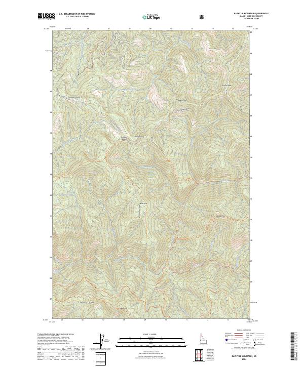
2024 Map of Bathtub Mountain
USGS Topo · Published 2024About this map
St Joe National Forest encompasses this high-elevation terrain in Shoshone County, defined by a complex network of ridges and drainages. The landscape is punctuated by prominent summits including Bathtub Mtn, Pineapple Peak, and Spotwean Peak, while the Bluff Divide serves as a primary geographic separator for the local waterways. The map reveals a trail-dense environment, where routes like the Snow Peak Trl and Lightning Ridge Trl follow the high ground, connecting remote points such as Fortune Point and Buck Point. The drainage patterns are intricate, with the West Fork Bluff Creek and East Fork Bluff Creek flowing north, while Canyon Creek and Caribou Creek carve through the southern sections. This area represents a well-preserved mountain ecosystem, with the name Bathtub Meadows suggesting a unique pocket of flatter terrain amidst the steep slopes of the Bitterroot range hinterlands.
Find a feature on this map
48 named features on this map. Tap any name to fly to it.
Don’t see what you’re looking for? This feature index may not catch every label — zoom into the map to look around manually.
Map Details
Editions of this 2024 Bathtub Mountain Map
This is the sole edition of this map. No revisions or reprints were ever made.
Other maps of this area

1911 · Lolo
USGS Topo · 1:250,000

1913 · Lolo
USGS Topo · 1:250,000

1914 · Avery
USGS Topo · 1:125,000

1917 · Avery
USGS Topo · 1:125,000

1918 · St Regis
USGS Topo · 1:125,000

1919 · St. Regis
USGS Topo · 1:125,000

1923 · Washington Creek
USGS Topo · 1:125,000

1956 · Wallace
USGS Topo · 1:250,000

1956 · Hamilton
USGS Topo · 1:250,000

1957 · Simmons Peak
USGS Topo · 1:62,500