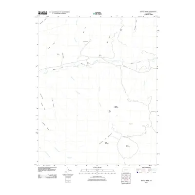
2010 Map of Battle Rock
USGS Topo · Published 2010About this map
McElmo Canyon and the surrounding high desert mesas define this southwestern Colorado landscape, where deep drainage systems like Pine Creek and Rock Creek carve through the arid terrain. The map reveals a history of extraction and sparse settlement, anchored by the presence of numerous small-scale mining operations including the Battle Rock Mine, Cliff House Mine, and Three States Mine. The Lamb Cemetery stands as a quiet marker of early pioneer presence along Road G, while much of the southern portion of the quadrangle is dominated by the imposing topography of Sleeping Ute Mountain and Ute Peak. This 2010 survey illustrates the remote character of Montezuma County, where modern infrastructure like Indian Rte 256 follows the natural contours of the land between prominent landmarks such as Hamilton Mesa and Horse Mountain.
Find a feature on this map
39 named features on this map. Tap any name to fly to it.
Don’t see what you’re looking for? This feature index may not catch every label — zoom into the map to look around manually.
Map Details
Editions of this 2010 Battle Rock Map
This is the sole edition of this map. No revisions or reprints were ever made.
Other maps of this area

1956 · Cortez
USGS Topo · 1:250,000

1957 · Moqui NW
USGS Topo · 1:24,000

1957 · Moqui SW
USGS Topo · 1:24,000

1957 · Moqui SE
USGS Topo · 1:24,000

1958 · Sentinel Peak NW
USGS Topo · 1:24,000

1958 · Cortez SW
USGS Topo · 1:24,000

1958 · Sentinel Peak NE
USGS Topo · 1:24,000

1958 · Cortez
USGS Topo · 1:250,000

1959 · Cortez
USGS Topo · 1:250,000

1962 · Cortez
USGS Topo · 1:250,000