
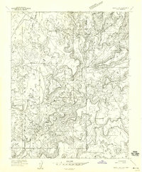
1958 Map of Sentinel Peak NW
USGS Topo · Published 1958About this map
Ute Mountain Indian Reservation land dominates this high desert landscape, captured during a 1957 geological survey. The terrain is defined by a complex network of seasonal drainage systems, including Marble Wash, Coyote Wash, and Mariano Wash, which carve through the arid plateau. Human activity is sparse, marked primarily by isolated infrastructure like Mariano Camp and several remote windmills used for water access in the dry environment. The presence of an Old North Boundary and the Aneth Road cutting across the central plains reveals the administrative and transportation history of the region. These tracks, along with various Jeep Trails, illustrate how the area was navigated before modern highway development, reflecting a period when the landscape was primarily utilized for ranching and resource management within the reservation boundaries.
Find a feature on this map
17 named features on this map. Tap any name to fly to it.
Don’t see what you’re looking for? This feature index may not catch every label — zoom into the map to look around manually.
Map Details
Editions of this 1958 Sentinel Peak NW Map
This is the sole edition of this map. No revisions or reprints were ever made.
Other maps of this area

1886 · Abajo
USGS Topo · 1:250,000

1892 · Abajo
USGS Topo · 1:250,000

1893 · Abajo
USGS Topo · 1:250,000

1956 · Cortez
USGS Topo · 1:250,000

1957 · Moqui SW
USGS Topo · 1:24,000

1957 · Moqui SE
USGS Topo · 1:24,000

1958 · Sentinel Peak NE
USGS Topo · 1:24,000

1958 · Cortez
USGS Topo · 1:250,000
1958 · Aneth 1 SE
USGS Topo · 1:24,000

1958 · Cajon Mesa
USGS Topo · 1:62,500