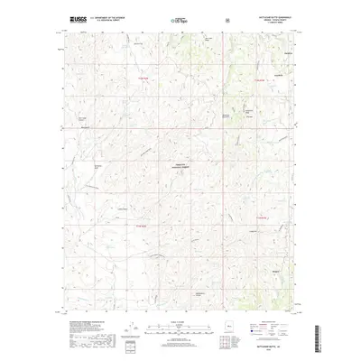
2018 Map of Battleship Butte
USGS Topo · Published 2018About this map
Dandrea and Goodwin sit along the eastern edge of this high-elevation terrain within the Prescott National Forest. The landscape is defined by the sharp relief of the Bradshaw Mountains, where numerous canyons like Box Canyon, Crooks Canyon, and Maidenhead Canyon cut through the rugged interior. This 2018 survey reveals a land shaped by resource extraction and seasonal water sources, featuring the Old Bodie Mine Road and the Blind Indian Connection. Throughout the quadrangle, a dense network of isolated springs and tanks, such as Tin Trough Spring, Eph Spring, and Ash Tank, highlights the essential reliance on scattered water points in this arid upland environment. The settlement at Hooper near Orr Spring further demonstrates the historical pattern of placing small outposts near dependable water and accessible trails.
Find a feature on this map
53 named features on this map. Tap any name to fly to it.
Don’t see what you’re looking for? This feature index may not catch every label — zoom into the map to look around manually.
Map Details
Editions of this 2018 Battleship Butte Map
This is the sole edition of this map. No revisions or reprints were ever made.
Other maps of this area

1887 · Prescott
USGS Topo · 1:250,000

1892 · Prescott
USGS Topo · 1:250,000

1903 · Bradshaw Mountains
USGS Topo · 1:125,000

1903 · Congress
USGS Topo · 1:125,000

1904 · Congress
USGS Topo · 1:125,000

1947 · Crown King
USGS Topo · 1:62,500

1947 · Mt. Union
USGS Topo · 1:62,500

1947 · Kirkland
USGS Topo · 1:62,500

1947 · Wagoner
USGS Topo · 1:62,500

1948 · Crown King
USGS Topo · 1:63,360