
1947 Map of Wagoner
USGS Topo · Published 1959About this map
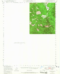
Wagoner serves as a central point of settlement in this high-desert territory of the Prescott National Forest, mapped just after the war. The landscape is defined by the Hassayampa River and its intricate drainage network, including Hackberry Gulch and Blind Indian Creek. Local ranching life is anchored by the Diamond 2 Ranch and Cooper Ranch, while the inclusion of an Airstrip near Wagoner points to the increasing importance of aerial access in remote Arizona during the late 1940s.
Find a feature on this map
25 named features on this map. Tap any name to fly to it.
Don’t see what you’re looking for? This feature index may not catch every label — zoom into the map to look around manually.
Map Details
Editions of this 1947 Wagoner Map
2 editions found
Other maps of this area

1887 · Prescott
USGS Topo · 1:250,000

1892 · Prescott
USGS Topo · 1:250,000

1903 · Bradshaw Mountains
USGS Topo · 1:125,000

1903 · Congress
USGS Topo · 1:125,000

1904 · Congress
USGS Topo · 1:125,000

1947 · Crown King
USGS Topo · 1:62,500

1947 · Mt. Union
USGS Topo · 1:62,500

1947 · Kirkland
USGS Topo · 1:62,500

1948 · Crown King
USGS Topo · 1:63,360

1948 · Kirkland
USGS Topo · 1:63,360