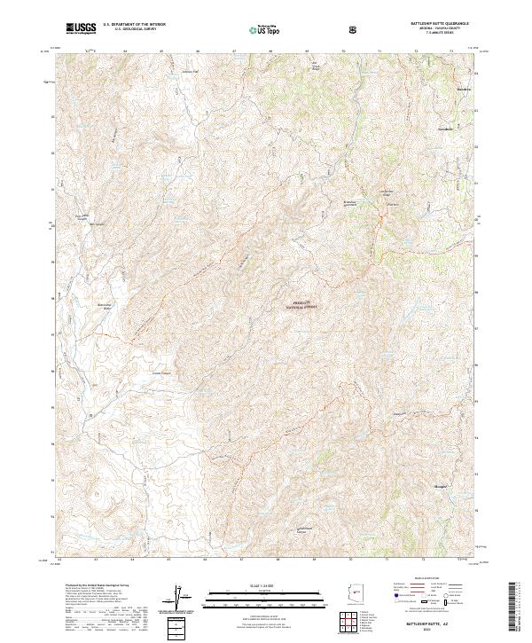
2021 Map of Battleship Butte
USGS Topo · Published 2021About this map
Battleship Butte rises as a prominent landmark within the Prescott National Forest, overlooking a complex network of canyons and high-altitude springs in Yavapai County. This high-desert and mountain terrain is defined by the Bradshaw Mountains and features like Maidenhead Canyon and Crooks Canyon, which create a landscape of sharp elevation changes. Small, remote settlements such as Goodwin and Dandrea sit in the northeast, while Hooper and Shady Dell anchor the southeastern portion of the map. The area is heavily marked by its mining and ranching history, evidenced by the Old Bodie Mine Road Trl and numerous named water sources like McNulty Spring, Tin Trough Spring, and Blackjack Spring. These springs and tanks, including Johnson Flat Tank and Upper Tank, highlight the critical importance of water management for livestock and mineral extraction in this arid Arizona environment.
Find a feature on this map
69 named features on this map. Tap any name to fly to it.
Don’t see what you’re looking for? This feature index may not catch every label — zoom into the map to look around manually.
Map Details
Editions of this 2021 Battleship Butte Map
This is the sole edition of this map. No revisions or reprints were ever made.
Other maps of this area

1887 · Prescott
USGS Topo · 1:250,000

1892 · Prescott
USGS Topo · 1:250,000

1903 · Bradshaw Mountains
USGS Topo · 1:125,000

1903 · Congress
USGS Topo · 1:125,000

1904 · Congress
USGS Topo · 1:125,000

1947 · Crown King
USGS Topo · 1:62,500

1947 · Mt. Union
USGS Topo · 1:62,500

1947 · Kirkland
USGS Topo · 1:62,500

1947 · Wagoner
USGS Topo · 1:62,500

1948 · Crown King
USGS Topo · 1:63,360