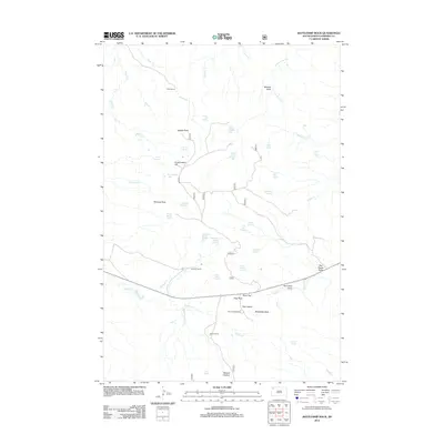
2012 Map of Battleship Rock
USGS Topo · Published 2012About this map
Olson Ranch and Lermeny Ranch sit within a landscape of named drainages and remote springs in this corner of Harding County. The terrain is defined by dramatic geological features such as The Castles, Flag Rock, and the distinctive Battleship Rock. This area serves as a vital water source in an arid region, documented through numerous named points like Little Joe Spring, Prairie Woman Spring, and Moonshine Lake. The settlement pattern is sparse, focusing on established ranching operations and recreation at Reva Campground near Reva Gap. Navigational markers like Government Hill and Saddle Point provide essential orientation across the network of draws and creeks, including Mitchell Draw and Tepee Canyon Cr.
Find a feature on this map
49 named features on this map. Tap any name to fly to it.
Don’t see what you’re looking for? This feature index may not catch every label — zoom into the map to look around manually.
Map Details
Editions of this 2012 Battleship Rock Map
This is the sole edition of this map. No revisions or reprints were ever made.
Other maps of this area

1935 · Reva
USGS Topo · 1:125,000

1935 · Hoover
USGS Topo · 1:125,000

1954 · Lemmon
USGS Topo · 1:250,000

1957 · Lemmon
USGS Topo · 1:250,000

1968 · J B Hill
USGS Topo · 1:24,000

1968 · Reva
USGS Topo · 1:24,000

1968 · Flat Top Butte
USGS Topo · 1:24,000

1969 · Battleship Rock
USGS Topo · 1:24,000

1969 · Reva NW
USGS Topo · 1:24,000

1969 · Reva NE
USGS Topo · 1:24,000