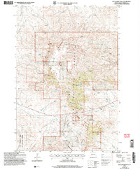
2005 Map of Battleship Rock
USGS Topo · Published 2007About this map
Custer National Forest encompasses the central portion of this Harding County landscape, where the dramatic rising topography of the Slim Buttes breaks the surrounding plains. The map identifies several family holdings that define the local ranching economy, including the Olson Ranch, Helms Ranch, and Lermeny Ranch. Transportation through this varied terrain relies on primitive routes like Red Cross Road and North End Road, which navigate the gaps between sandstone formations. Notable landmarks such as the namesake Battleship Rock, Flag Rock, and Saddle Point serve as distinct navigational markers. A network of springs, including Lena Spring No 1 and Red Cross Spring, provides essential water sources in this arid environment, supporting both livestock and the State Experiment Farm and Antelope Reserve located in the southwest corner.
Find a feature on this map
52 named features on this map. Tap any name to fly to it.
Don’t see what you’re looking for? This feature index may not catch every label — zoom into the map to look around manually.
Map Details
Editions of this 2005 Battleship Rock Map
This is the sole edition of this map. No revisions or reprints were ever made.
Other maps of this area

1935 · Reva
USGS Topo · 1:125,000

1935 · Hoover
USGS Topo · 1:125,000

1954 · Lemmon
USGS Topo · 1:250,000

1957 · Lemmon
USGS Topo · 1:250,000

1968 · J B Hill
USGS Topo · 1:24,000

1968 · Reva
USGS Topo · 1:24,000

1968 · Flat Top Butte
USGS Topo · 1:24,000

1969 · Battleship Rock
USGS Topo · 1:24,000

1969 · Reva NW
USGS Topo · 1:24,000

1969 · Reva NE
USGS Topo · 1:24,000