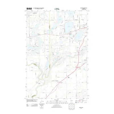
2013 Map of Baxter
USGS Topo · Published 2013About this map
The Mississippi River and Crow Wing River converge in the southern portion of this landscape, marking a historic junction where water transport shaped the early development of Crow Wing County. The map documents the residential expansion of Baxter and East Gull Lake, areas characterized by a dense network of suburban roads such as Cedar Scenic Rd and Crystal Rd N that weave between glacial water bodies including White Sand Lake and Rush Lake. Genealogists will find several burial sites preserved here, from the Saint Francis Assisi Catholic Cem near the river to the specific Prosser Farm Site Cem further west. The proximity of the settlement at Barrows to Mine Lake points to the region's industrial ties, while the Little Pine Resort and Campground illustrates the area's long-standing role as a recreational destination in central Minnesota.
Find a feature on this map
119 named features on this map. Tap any name to fly to it.
Don’t see what you’re looking for? This feature index may not catch every label — zoom into the map to look around manually.
Map Details
Editions of this 2013 Baxter Map
This is the sole edition of this map. No revisions or reprints were ever made.
Other maps of this area

1915 · Brainerd
USGS Topo · 1:62,500

1916 · Pillager
USGS Topo · 1:62,500

1918 · Brainerd
USGS Topo · 1:62,500

1919 · Pillager
USGS Topo · 1:62,500

1948 · Belle Prairie
USGS Topo · 1:62,500

1948 · Lastrup
USGS Topo · 1:62,500

1950 · Lastrup
USGS Topo · 1:62,500

1950 · Belle Prairie
USGS Topo · 1:62,500

1953 · Brainerd
USGS Topo · 1:250,000

1954 · Baxter
USGS Topo · 1:24,000