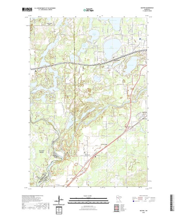
2022 Map of Baxter
USGS Topo · Published 2022About this map
The Mississippi River and Crow Wing River converge at the southern edge of this map, marking a landscape defined by significant water bodies and historic transitions. The city of Baxter serves as a central hub, surrounded by a dense network of lakes including White Sand Lake, Upper Whipple Lake, and Red Sand Lake. This modern-era survey provides valuable data for genealogists and local historians through the identification of several specific burial grounds, such as the Gull River Cem and the Prosser Farm Site Cem. The presence of the Saint John Holy Cross Episcopal Cem and Saint Francis Assisi Catholic Cem reflects the established community roots near the river junction. Further south, the settlement of Crow Wing sits near the tri-county boundary where Cass, Morrison, and Crow Wing counties meet, illustrating the region's complex administrative geography and its enduring relationship with the river systems.
Find a feature on this map
166 named features on this map. Tap any name to fly to it.
Don’t see what you’re looking for? This feature index may not catch every label — zoom into the map to look around manually.
Map Details
Editions of this 2022 Baxter Map
This is the sole edition of this map. No revisions or reprints were ever made.
Other maps of this area

1915 · Brainerd
USGS Topo · 1:62,500

1916 · Pillager
USGS Topo · 1:62,500

1918 · Brainerd
USGS Topo · 1:62,500

1919 · Pillager
USGS Topo · 1:62,500

1948 · Belle Prairie
USGS Topo · 1:62,500

1948 · Lastrup
USGS Topo · 1:62,500

1950 · Lastrup
USGS Topo · 1:62,500

1950 · Belle Prairie
USGS Topo · 1:62,500

1953 · Brainerd
USGS Topo · 1:250,000

1954 · Baxter
USGS Topo · 1:24,000