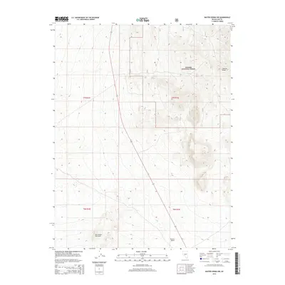
2014 Map of Baxter Spring NW
USGS Topo · Published 2014About this map
The Toquima Range and the San Antonio Mountains define the high-relief landscape of this central Nevada survey. Much of the northeastern quadrant is occupied by the protected lands of the Toyiabe National Forest, where the terrain rises sharply from the basin floor. This environment is characterized by the stark contrast between the elevated forest slopes and the arid expanse of the Ralston Desert to the south. A single reliable water source, Willow Spring, is noted in the northern reaches of the range. The map provides a technical view of the land division within Nye County, documenting the boundaries of t7n r42e, t7n r43e, t6n r42e, and t6n r43e. State Route 376 serves as the primary north-south corridor, tracing the alluvial plains between the mountain systems.
Find a feature on this map
10 named features on this map. Tap any name to fly to it.
Don’t see what you’re looking for? This feature index may not catch every label — zoom into the map to look around manually.
Map Details
Editions of this 2014 Baxter Spring NW Map
This is the sole edition of this map. No revisions or reprints were ever made.
Other maps of this area

1907 · Tonopah
USGS Topo · 1:250,000

1908 · Tonopah
USGS Topo · 1:250,000

1956 · Tonopah
USGS Topo · 1:250,000

1959 · Tonopah
USGS Topo · 1:250,000

1962 · Tonopah
USGS Topo · 1:250,000

1963 · Baxter Spring
USGS Topo · 1:62,500

1964 · San Antonio Ranch
USGS Topo · 1:62,500

1971 · Seyler Peak
USGS Topo · 1:24,000

1971 · Manhattan
USGS Topo · 1:24,000
1980 · Peavine Ranch
USGS Topo · 1:24,000