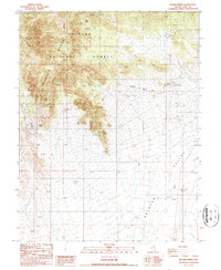
1987 Map of Baxter Spring
USGS Topo · Published 1987About this map
Toiyabe National Forest encompasses the high-altitude divide where the Toiyabe Range and Toquima Range meet in central Nevada. This 1980s provisional survey documents a landscape defined by its critical water sources and rugged relief, transitioning from the mountain peaks down into the arid expanse of the Ralston Valley. The map records numerous named water features essential for survival in this high desert environment, including Indian Spring, Spanish Spring, and Baxter Spring.
Find a feature on this map
20 named features on this map. Tap any name to fly to it.
Don’t see what you’re looking for? This feature index may not catch every label — zoom into the map to look around manually.
Map Details
Editions of this 1987 Baxter Spring Map
This is the sole edition of this map. No revisions or reprints were ever made.
Other maps of this area

1907 · Tonopah
USGS Topo · 1:250,000

1908 · Tonopah
USGS Topo · 1:250,000

1956 · Tonopah
USGS Topo · 1:250,000

1959 · Tonopah
USGS Topo · 1:250,000

1962 · Tonopah
USGS Topo · 1:250,000

1963 · Baxter Spring
USGS Topo · 1:62,500

1971 · Antelope Spring
USGS Topo · 1:24,000

1971 · Seyler Peak
USGS Topo · 1:24,000

1971 · Manhattan
USGS Topo · 1:24,000

1971 · Belmont West
USGS Topo · 1:24,000