
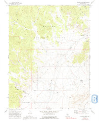
1971 Map of Belmont West
USGS Topo · Published 1975About this map
Belmont stands as the primary cultural landmark on this 1971 survey, where the Old Courthouse (Ruins) reflects the area's once-prominent status as a regional center. To the west, the landscape transitions into the high terrain of Bald Mountain and the Toiyabe National Forest, while the wide expanse of Ralston Valley dominates the central portion of the sheet. For genealogists and local historians, the presence of the Anderson Cem and the Belmont Cem near Cemetery Hill provides specific points for tracing early residents of this high desert environment.
Find a feature on this map
26 named features on this map. Tap any name to fly to it.
Don’t see what you’re looking for? This feature index may not catch every label — zoom into the map to look around manually.
Map Details
Editions of this 1971 Belmont West Map
2 editions found
Other maps of this area

1907 · Tonopah
USGS Topo · 1:250,000

1908 · Tonopah
USGS Topo · 1:250,000

1956 · Tonopah
USGS Topo · 1:250,000

1959 · Tonopah
USGS Topo · 1:250,000

1962 · Tonopah
USGS Topo · 1:250,000

1963 · Baxter Spring
USGS Topo · 1:62,500

1971 · Belmont East
USGS Topo · 1:24,000

1971 · Corcoran Canyon
USGS Topo · 1:24,000

1971 · Manhattan
USGS Topo · 1:24,000

1971 · Jefferson
USGS Topo · 1:24,000