
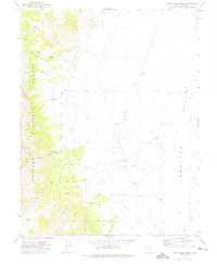
1971 Map of Jefferson
USGS Topo · Published 1975About this map
Mining operations and high-elevation camps define this 1971 study of the Toiyabe Range in Nevada. The settlement of Jefferson is marked by scattered structures and ruins at the head of Berlin Canyon, signaling the area's silver mining heritage. Resource extraction remains a central theme across the landscape, with the Barcelona Mine and Van Ness Mine located south of Barcelona Summit, and the Flower Mine situated near Ryecroft Canyon.
Find a feature on this map
45 named features on this map. Tap any name to fly to it.
Don’t see what you’re looking for? This feature index may not catch every label — zoom into the map to look around manually.
Map Details
Editions of this 1971 Jefferson Map
This is the sole edition of this map. No revisions or reprints were ever made.
Other maps of this area

1907 · Tonopah
USGS Topo · 1:250,000

1908 · Tonopah
USGS Topo · 1:250,000

1956 · Tonopah
USGS Topo · 1:250,000

1959 · Tonopah
USGS Topo · 1:250,000

1962 · Tonopah
USGS Topo · 1:250,000

1971 · Belmont East
USGS Topo · 1:24,000

1971 · Corcoran Canyon
USGS Topo · 1:24,000

1971 · Manhattan
USGS Topo · 1:24,000

1971 · Belmont West
USGS Topo · 1:24,000
1971 · Pine Creek Ranch
USGS Topo · 1:24,000