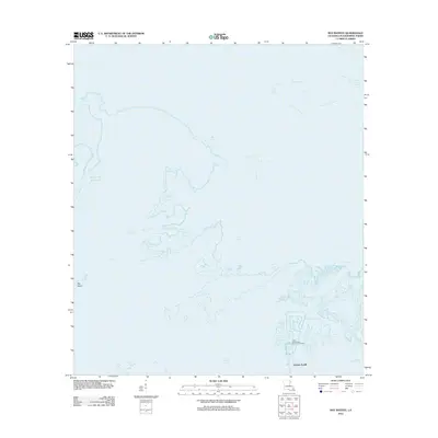
2012 Map of Bay Batiste
USGS Topo · Published 2012About this map
Grande Ecaille and the surrounding marshlands of Plaquemines Parish appear in this coastal survey, highlighting the complex relationship between Louisiana's wetlands and its energy infrastructure. The southern portion of the map is dominated by the Lake Washington Oil and Gas Field, showing a dense network of canals and industrial footprints in an area defined by water. North of Lake Grand Ecaille, the landscape dissolves into a labyrinth of waterways including Bay Batiste, Rattlesnake Bayou, and Lost Bayou. Large-scale man-made features like the Robinson Canal and Socola Canal Number Two cut through the natural drainage, illustrating the significant engineering required to navigate and utilize these tidal basins. The map provides a detailed view of these fragile landforms, from Big Island in the west to the winding course of Two Sisters Bayou in the northeast.
Find a feature on this map
13 named features on this map. Tap any name to fly to it.
Don’t see what you’re looking for? This feature index may not catch every label — zoom into the map to look around manually.
Map Details
Editions of this 2012 Bay Batiste Map
This is the sole edition of this map. No revisions or reprints were ever made.
Other maps of this area

1891 · Pointe a La Hache
USGS Topo · 1:62,500

1892 · Quarantine
USGS Topo · 1:62,500

1892 · Pointe a La Hache
USGS Topo · 1:62,500

1893 · Fort Livingston
USGS Topo · 1:62,500

1893 · Dime
USGS Topo · 1:62,500

1935 · Port Sulphur
USGS Topo · 1:31,680

1935 · Bastian Bay
USGS Topo · 1:31,680

1935 · Bay Ronquille
USGS Topo · 1:31,680

1935 · Wilkinson Bay
USGS Topo · 1:31,680

1939 · Pointe a La Hache
USGS Topo · 1:62,500