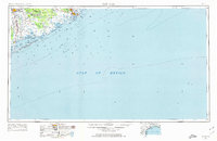
1956 Map of Bay City
USGS Topo · Published 1974About this map
The coastal shelf of the Gulf of Mexico meets the Texas shoreline in this 1950s era survey, where the heavy industry of the Sulphur plant and a coastal Refinery stand alongside traditional river crossings like Hinkles Ferry. The landscape is defined by the complex hydrology of the Old Brazos River and Caney Creek, which meander toward East Matagorda Bay. Inland, Bay City serves as a regional hub connected by the Missouri Pacific and Santa Fe railroads.
Find a feature on this map
54 named features on this map. Tap any name to fly to it.
Don’t see what you’re looking for? This feature index may not catch every label — zoom into the map to look around manually.
Map Details
Editions of this 1956 Bay City Map
2 editions found

Other maps of this area

1933 · San Luis Pass
USGS Topo · 1:31,680

1943 · San Luis Pass
USGS Topo · 1:31,680

1943 · Oyster Creek
USGS Topo · 1:31,680

1943 · Jones Creek
USGS Topo · 1:31,680

1943 · Freeport
USGS Topo · 1:31,680

1943 · Cedar Lakes East
USGS Topo · 1:24,000

1943 · Christmas Point
USGS Topo · 1:24,000

1943 · Snipe
USGS Topo · 1:31,680

1950 · Corpus Christi
USGS Topo · 1:250,000

1950 · Houston
USGS Topo · 1:250,000