
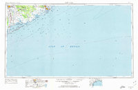
1956 Map of Bay City
USGS Topo · Published 1964About this map
Matagorda Bay and the surrounding coastal lowlands are mapped here during a period of transition for the Texas Gulf Coast. The landscape is defined by its complex hydrology, where the Colorado River meets the sea and the long, thin barrier of the Matagorda Peninsula separates the Gulf of Mexico from the inland waters of East Matagorda Bay. Smaller settlements like Wadsworth and Sargent appear alongside industrial markers such as a Refinery and an Underground pipeline, reflecting the regional significance of the oil and gas industry in the mid-20th century. The intricate network of coastal features, including Brown Cedar Cut and Canoe Bayou, illustrates the shifting shoreline and the wetlands that dominate Matagorda County and Brazoria County before extensive modern development altered the coast.
Find a feature on this map
42 named features on this map. Tap any name to fly to it.
Don’t see what you’re looking for? This feature index may not catch every label — zoom into the map to look around manually.
Map Details
Editions of this 1956 Bay City Map
2 editions found
Other maps of this area

1933 · San Luis Pass
USGS Topo · 1:31,680

1943 · San Luis Pass
USGS Topo · 1:31,680

1943 · Oyster Creek
USGS Topo · 1:31,680

1943 · Jones Creek
USGS Topo · 1:31,680

1943 · Freeport
USGS Topo · 1:31,680

1943 · Cedar Lakes East
USGS Topo · 1:24,000

1943 · Christmas Point
USGS Topo · 1:24,000

1943 · Snipe
USGS Topo · 1:31,680

1950 · Corpus Christi
USGS Topo · 1:250,000

1950 · Houston
USGS Topo · 1:250,000