
1933 Map of San Luis Pass
USGS Topo · Published 1933About this map
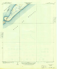
Galveston Island terminates at its southwestern tip in this 1930s survey, where the San Luis Pass separates it from San Luis Island. This coastal geography reveals the strategic maritime positioning of the era, marked prominently by the San Luis Coast Guard station guarding the narrow inlet between the Gulf of Mexico and the calmer waters of West Bay. Compiled in part from aerial photographs taken by the Army Air Corps, the map captures the precise shoreline and tidal environment before modern developments altered the barrier island's profile. The boundary between Brazoria and Galveston Counties is clearly delineated as it cuts through the pass, providing a snapshot of the jurisdictional and physical landscape of the Texas coast during the early 1930s.
Find a feature on this map
7 named features on this map. Tap any name to fly to it.
Don’t see what you’re looking for? This feature index may not catch every label — zoom into the map to look around manually.
Map Details
Editions of this 1933 San Luis Pass Map
2 editions found
Other maps of this area

1929 · Karankawa Lake
USGS Topo · 1:24,000

1931 · Lake Como
USGS Topo · 1:24,000

1933 · Karankawa Lake
USGS Topo · 1:31,680
1933 · Lake Como
USGS Topo · 1:31,680

1943 · San Luis Pass
USGS Topo · 1:31,680
1943 · Lake Como
USGS Topo · 1:25,000
1943 · Carancahua Lake
USGS Topo · 1:24,000

1943 · Christmas Point
USGS Topo · 1:24,000

1943 · Chocolate Bay
USGS Topo · 1:24,000

1950 · Houston
USGS Topo · 1:250,000