
1943 Map of Freeport
USGS Topo · Published 1943About this map
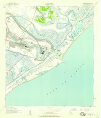
Freeport and the neighboring settlement of Velasco dominate this mid-century coastal survey, situated where the Old Brazos River meets the Gulf of Mexico. During this period, the landscape is defined by the heavy infrastructure of the Missouri Pacific railroad and a developing Golf Course, contrasted against the natural meandering of Oyster Creek and East Union Bayou. The coastal area shows the critical importance of maritime navigation and water-based transport, featuring the Brazos River Lighthouse at the river's mouth and both the Intracoastal Waterway and its older predecessor. Inland, the map captures a mix of residential growth in Velasco Heights and Midway, while the low-lying marshlands are dotted with curiously named features like the Slop Bowl and family-named landmarks such as Bryan Mound and Bryan Lake. The presence of the Quintana Cem provides a specific point of interest for genealogists tracing early coastal families.
Find a feature on this map
25 named features on this map. Tap any name to fly to it.
Don’t see what you’re looking for? This feature index may not catch every label — zoom into the map to look around manually.
Map Details
Editions of this 1943 Freeport Map
2 editions found
Other maps of this area

1943 · Oyster Creek
USGS Topo · 1:31,680

1943 · Jones Creek
USGS Topo · 1:31,680

1943 · Cedar Lakes East
USGS Topo · 1:24,000

1943 · Christmas Point
USGS Topo · 1:24,000

1943 · Snipe
USGS Topo · 1:31,680

1950 · Houston
USGS Topo · 1:250,000

1951 · Bay City
USGS Topo · 1:250,000

1956 · Houston
USGS Topo · 1:250,000

1956 · Bay City
USGS Topo · 1:250,000

1958 · Bay City
USGS Topo · 1:250,000