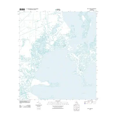
2012 Map of Bay L'Ours
USGS Topo · Published 2012About this map
The labyrinthine wetlands of Jefferson Parish are dominated by the expanse of Little Lake and the industrial footprint of energy extraction in the early 21st century. This coastal landscape is defined by the intersection of natural waterways and man-made channels, notably the Harvey Cutoff and Bayou Perot. The presence of the Little Lake Oil and Gas Field and the Little Temple Oil and Gas Field indicates the region's role in Louisiana's petroleum industry, with infrastructure integrated directly into the marsh environment. Water dominates the geography, with Bay L'Ours at the southern edge and Bayou Rigolettes snaking through the northern reaches. The survey captures a moment in the shifting deltaic landscape where traditional bayous like Bayou de la Gauche meet the wide basins of Turtle Bay, reflecting the ongoing environmental and economic character of the Mississippi River delta system.
Find a feature on this map
9 named features on this map. Tap any name to fly to it.
Don’t see what you’re looking for? This feature index may not catch every label — zoom into the map to look around manually.
Map Details
Editions of this 2012 Bay L'Ours Map
This is the sole edition of this map. No revisions or reprints were ever made.
Other maps of this area

1892 · Barataria
USGS Topo · 1:62,500

1892 · Cut-Off
USGS Topo · 1:62,500

1892 · Creole
USGS Topo · 1:62,500

1894 · Lake Felicity
USGS Topo · 1:62,500

1935 · Golden Meadow
USGS Topo · 1:31,680

1939 · Cut-Off
USGS Topo · 1:62,500

1939 · Lake Felicity
USGS Topo · 1:62,500

1941 · Cut-Off
USGS Topo · 1:62,500

1941 · Lake Felicity
USGS Topo · 1:62,500

1941 · Barataria
USGS Topo · 1:62,500