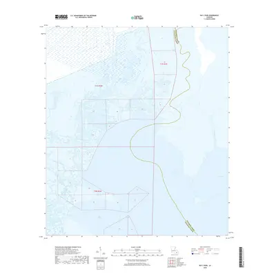
2018 Map of Bay L'Ours
USGS Topo · Published 2018About this map
Bay L'Ours dominates this coastal landscape where the low-lying wetlands of Southeast Louisiana meet the open waters of the Gulf interior. The map illustrates a complex network of waterways, primarily the meandering Bayou de la Gauche and the wide expanse of Bayou Perot. These natural channels are contrasted by the straight-line engineering of the Harvey Cutoff, reflecting the region's reliance on managed water routes for navigation and local industry. The boundary between Jefferson Parish and Lafourche Parish snakes through the center of the sheet, following historical watercourses that define local jurisdiction. This 2018 survey captures the intricate transition between marshland and open bay, documenting the specific shoreline of Turtle Bay and the surrounding township and range divisions during a period of ongoing coastal change.
Find a feature on this map
9 named features on this map. Tap any name to fly to it.
Don’t see what you’re looking for? This feature index may not catch every label — zoom into the map to look around manually.
Map Details
Editions of this 2018 Bay L'Ours Map
This is the sole edition of this map. No revisions or reprints were ever made.
Other maps of this area

1892 · Barataria
USGS Topo · 1:62,500

1892 · Cut-Off
USGS Topo · 1:62,500

1892 · Creole
USGS Topo · 1:62,500

1894 · Lake Felicity
USGS Topo · 1:62,500

1935 · Golden Meadow
USGS Topo · 1:31,680

1939 · Cut-Off
USGS Topo · 1:62,500

1939 · Lake Felicity
USGS Topo · 1:62,500

1941 · Cut-Off
USGS Topo · 1:62,500

1941 · Lake Felicity
USGS Topo · 1:62,500

1941 · Barataria
USGS Topo · 1:62,500