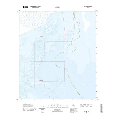
2020 Map of Bay L'Ours
USGS Topo · Published 2020About this map
The low-lying aquatic landscape of the Jefferson Parish and Lafourche Parish boundary comes into sharp focus through this late-era survey. The region is defined by a complex web of wetlands and waterways, where the waters of Bay L'Ours and Turtle Bay meet the coastal marsh. The map illustrates how human intervention has shaped these wetlands, most notably through the Harvey Cutoff, a significant navigational corridor that cuts through the natural hydrology of the bayous. These coastal reaches, including Bayou Perot and Bayou Rigolettes, reflect a landscape that is both ecologically sensitive and historically vital for water-borne transit in southern Louisiana. The grid systems of T17S R22E and T18S R22E underscore the formal land divisions that overlie this fluid environment of winding channels like Bayou de la Gauche.
Find a feature on this map
11 named features on this map. Tap any name to fly to it.
Don’t see what you’re looking for? This feature index may not catch every label — zoom into the map to look around manually.
Map Details
Editions of this 2020 Bay L'Ours Map
This is the sole edition of this map. No revisions or reprints were ever made.
Other maps of this area

1892 · Barataria
USGS Topo · 1:62,500

1892 · Cut-Off
USGS Topo · 1:62,500

1892 · Creole
USGS Topo · 1:62,500

1894 · Lake Felicity
USGS Topo · 1:62,500

1935 · Golden Meadow
USGS Topo · 1:31,680

1939 · Cut-Off
USGS Topo · 1:62,500

1939 · Lake Felicity
USGS Topo · 1:62,500

1941 · Cut-Off
USGS Topo · 1:62,500

1941 · Lake Felicity
USGS Topo · 1:62,500

1941 · Barataria
USGS Topo · 1:62,500