Loading...
Loading map...1981 Map of Bay Minette
USGS Topo · Published 1991About this map
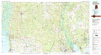
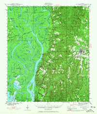
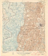
The Tensaw River and Mobile River delta system dominates the western edge of this 1981 survey, where complex waterways like the Middle River and Raa River wind through islands such as Gravine Island and Mound Island. This coastal and riverine landscape is punctuated by numerous historic landings, including Barlow Landing and Steam Mill Landing, hinting at the long history of water-based transport in Baldwin County.
Find a feature on this map
158 named features on this map. Tap any name to fly to it.
Don’t see what you’re looking for? This feature index may not catch every label — zoom into the map to look around manually.
Map Details
Date Portrayed1981
Date Published1991
PublisherU.S. Geological Survey
Map TypeTopographic
Scale1:100,000
Physical Dimensions43.5 x 23.9 inches
Editions of this 1981 Bay Minette Map
2 editions found

Historical Maps of Mobile Through Time
3 maps found
Featured Locations
Source Details
SourceU.S. Geological Survey
CopyrightPublic Domain