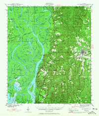
1941 Map of Bay Minette
USGS Topo · Published 1965About this map
Bay Minette serves as the focal point for this survey of the northern Mobile-Tensaw River Delta, a landscape defined by an intricate network of waterways including the Tensaw River, Mobile River, and Middle River. The map illustrates the region's heavy reliance on both water and rail transportation just before mid-century, with the Louisville & Nashville RR cutting through the terrain and stopping at points like Ortiz Siding. The riverfront is dotted with named points of interest for local history, such as Twentyseven Mile Bluff and Willow Point, while the interior shows established rural communities connected by the historic Nashville Road.
Find a feature on this map
108 named features on this map. Tap any name to fly to it.
Don’t see what you’re looking for? This feature index may not catch every label — zoom into the map to look around manually.
Map Details
Editions of this 1941 Bay Minette Map
2 editions found
Other maps of this area

1920 · Robertsdale
USGS Topo · 1:62,500

1921 · Fairhope
USGS Topo · 1:62,500

1922 · Mobile
USGS Topo · 1:62,500

1940 · Mobile
USGS Topo · 1:31,680

1940 · Mobile
USGS Topo · 1:62,500

1941 · Chickasaw
USGS Topo · 1:31,680

1941 · Blakeley
USGS Topo · 1:31,680

1941 · Bay Minette
USGS Topo · 1:62,500

1941 · Robertsdale
USGS Topo · 1:62,500

1941 · Creola
USGS Topo · 1:62,500